The salt marsh myth
Between 2008-2010, a number of groups mistook a man-made salt water flooding of the Tsawout lands, Puckle Farm, and the northwest part of the CRD park, as a salt marsh.
- The Ministry of the Environment in the 2009 Stacey Filatow TEM report
- The 2010 Cordova Strategy
- The Central Saanich OCP
- The CRD
The cause of the salt water flooding was the failure of the flapper gate on the ditch system running through the Tsawout lands, which allowed sea water to flow up the ditch for more than 20 years from the 1980's until the present. Repairs were made to the flapper gate in 2012 which partially closed the gate, but sea water still comes up, and is present in the Tsawout ditch system year round.
Background
Precontact: This land was first surveyed in 1858, and the surveyor's notes described the land as low rush and grass bottom, and in several parts he made reference to pacific crabapple trees. There was no mention of water nor is there blue shading on the survey map, as the surveyor used to describe wet land on the other side of the ridge to the west.
Early settlors - good land The flat land of Puckle Farm, which lay to the south of the Tsawout lands and ran to the sea, (most of which is now the north part of the CRD park) was described:
- in March 1892 as having 30 acres of good land.
- Later there was another description of all the flat lands as "50 acres of pasture extending from the foot of the ridge to the sea."
- And in 1906 the Puckle Farm flat lands were described as "below the ridge facing the sea, 18 acres have been usually cropped with oats which yielded 18 bushels an acre in 1906. East of this, 3 fields of about 9 acres each are pasture hitherto fed by sheep."
These three descriptions of the Puckle Farm flat lands as being good land, were all before any drainage was done to the land. Clearly it was not a salt marsh when the first surveyor went there in 1858, nor would any farmer have described a salt marsh as "good land" or been able to grow oats there.
World War I - the first drainage ditch. A drainage ditch was built on the Tsawout lands to enable the military to train there. That ditch cut through a protective berm, and a flapper gate was installed to keep the sea out. In 1927, and in 1935, and again from some time in the 1980's to the present, the flapper gate failed. This allowed sea water to flow up the ditch instead of draining fresh water out.
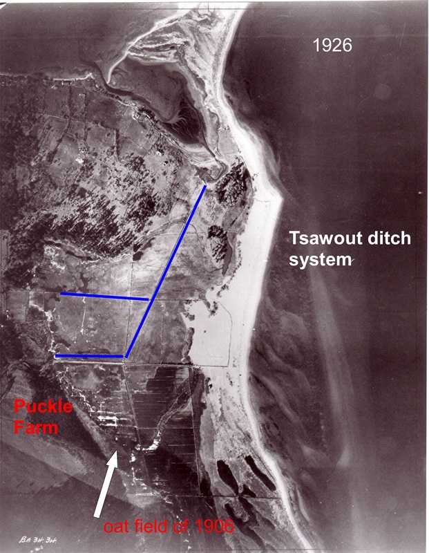
The ditch system built on the Tsawout lands in WWI

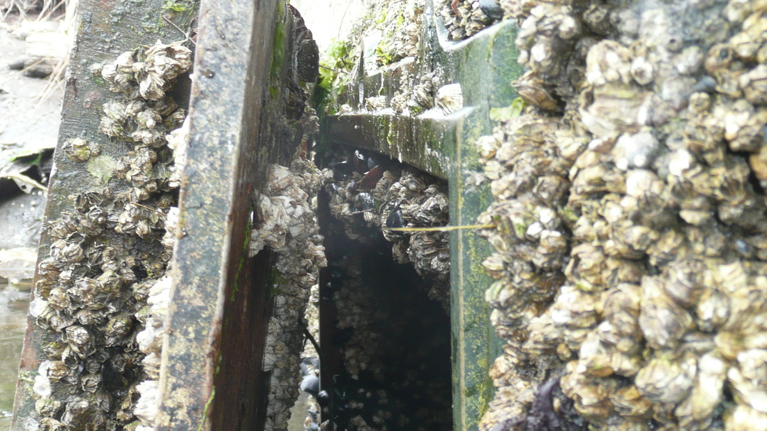
The open flapper gate as found in 2011
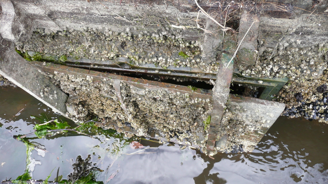
The following videos show the sea water passing through the flapper gate and back up the Tsawout ditch towards Puckle Farm and the CRD park.
What is particularly important, is to observe that the sea water is flowing up within the confines of the clearly man made ditch, and is not flowing over the land. This was the obvious clue missed by the researchers in 2008 - they saw what they wanted to see, instead of making scientific study.
2015 - showing the sea water coming through the Tsawout flapper gate
2015 - showing the sea water going up the Tsawout ditch towards Puckle Farm and the CRD park
Sea weed in the Tsawout ditch where it meets Puckle Farm and the CRD park 2012
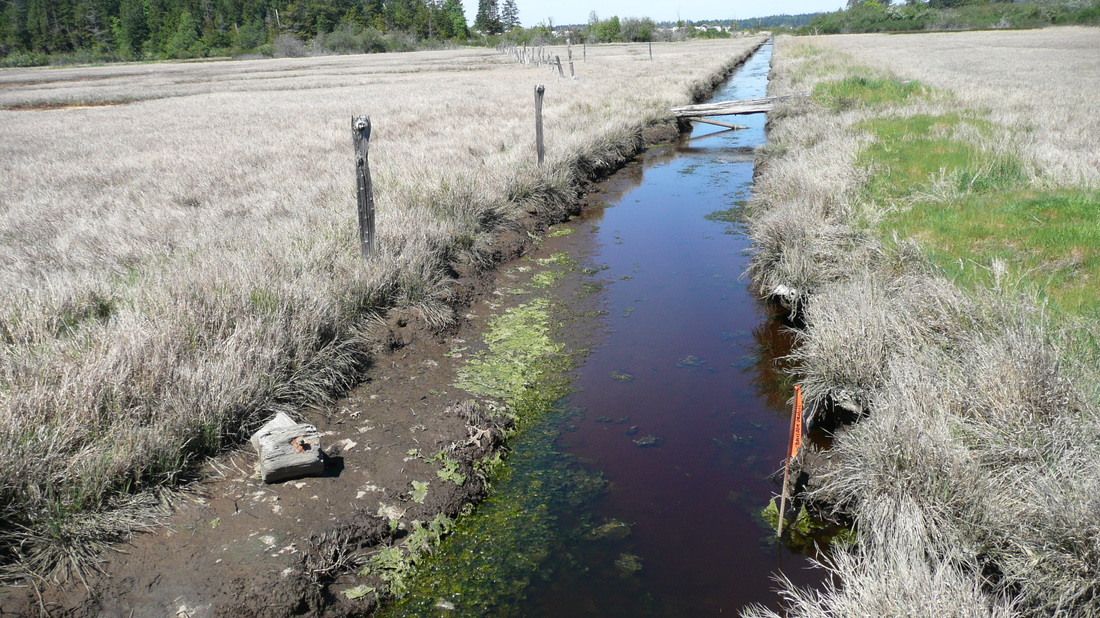
The following images show the sea water in the Tsawout ditches in every year, even when the surrounding land is parched. And they show for 2010 & 2011 the saltwater flooding from those ditches into Puckle Farm.
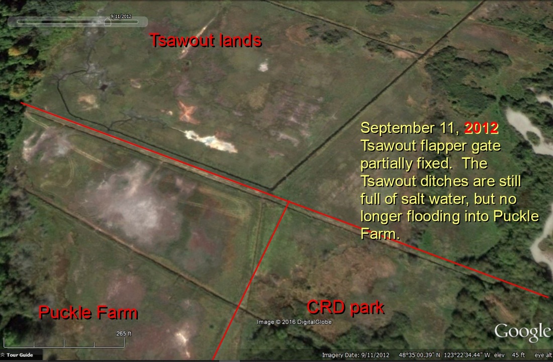
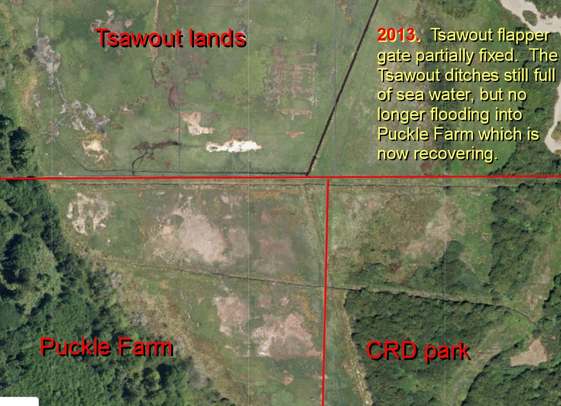
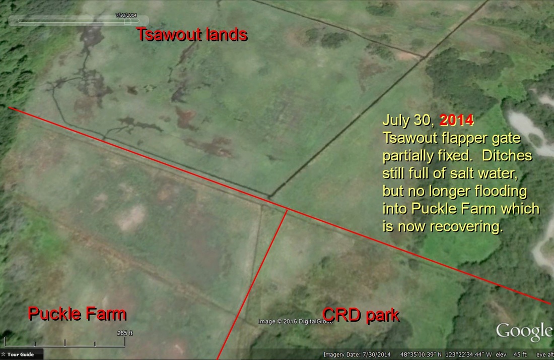
The Tsawout flapper gate was partially fixed in 2012 and from that time the volume of sea water was reduced and no longer floods into Puckle Farm, but is still present in the ditches.
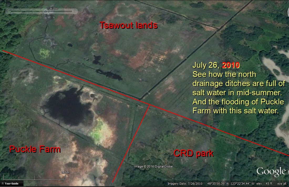
July 2010 - showing the Tsawout ditches full of salt water and the overflow of salt water into Puckle Farm

July 2010 - showing the salt water in the Tsawout ditches; the salt water flooding of Puckle Farm. And how dry the remaining countryside is.

July 2011 - the salt water flooding of Puckle Farm from the Tsawout ditch with the open flapper gate

May 2012 - Puckle Farm dry after Central Saanich cleaned the CRD's ditches in October 2011, and the Tsawout flapper gate had been partially fixed, so the volume of sea water was reduced and no longer flowed into Puckle Farm.