An overview of Island View
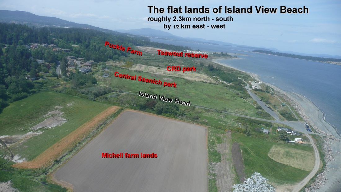
Island View Beach Regional park forms part of the flat lands on the east side of the Saanich Peninsula. It is accessed by Island View Road.
The flat lands stretch approximately 3.4km from the tip of Cordova Spit in the north to Michell Farms in the south.
The area was surveyed by John Trutch in 1858 into 100 acre blocks. Puckle Farm is the last surviving full block.
The area of the flat lands is approximately 300 acres, of which the CRD park is roughly 140 acres.
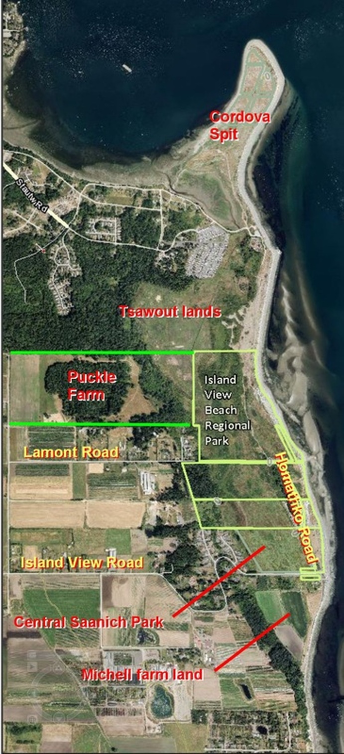
Although not apparent on the ground, the park is split east west by Lamont Road, and north south by Homathko Road.
Going from south to north, the primary land owners are the Michell Farm lands south of Island View Road; then the Central Saanich Municipal Park; then the CRD Park; Puckle Farm; the Tsawout lands; and finally the end of Cordova Spit owned by Central Sanich.
The flat lands stretch approximately 3.4km from the tip of Cordova Spit in the north to Michell Farms in the south.
The area was surveyed by John Trutch in 1858 into 100 acre blocks. Puckle Farm is the last surviving full block.
The area of the flat lands is approximately 300 acres, of which the CRD park is roughly 140 acres.
Although not apparent on the ground, the park is split east west by Lamont Road, and north south by Homathko Road.
Going from south to north, the primary land owners are the Michell Farm lands south of Island View Road; then the Central Saanich Municipal Park; then the CRD Park; Puckle Farm; the Tsawout lands; and finally the end of Cordova Spit owned by Central Sanich.