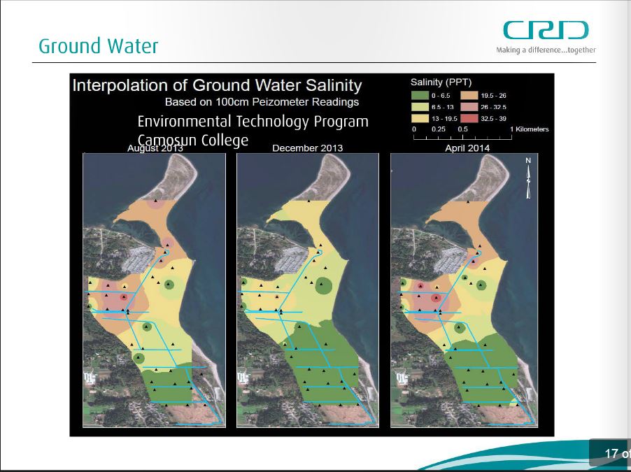
Salinity in the north
The CRD presentation here showed a map of the north part of the park and the Tsawout lands called "Interpolation of Ground Water Salinity" with the claim that in the late summer and early spring the area is dominated by salt and brackish water.
Despite having been reminded of this before and during the public meetings, the CRD not only failed to disclose, but expressly denied at the February 5, 2015 public meeting, that the flapper gate on the Tsawout ditch system failed at least 25 years ago, and for these 25 years including to the current time, those Tsawout ditches have full of salt water, and this is undoubtedly a significant cause of the high salinity in that area.
It is incomprehensible that the CRD would fail to disclose this.
This was what the CRD presented:
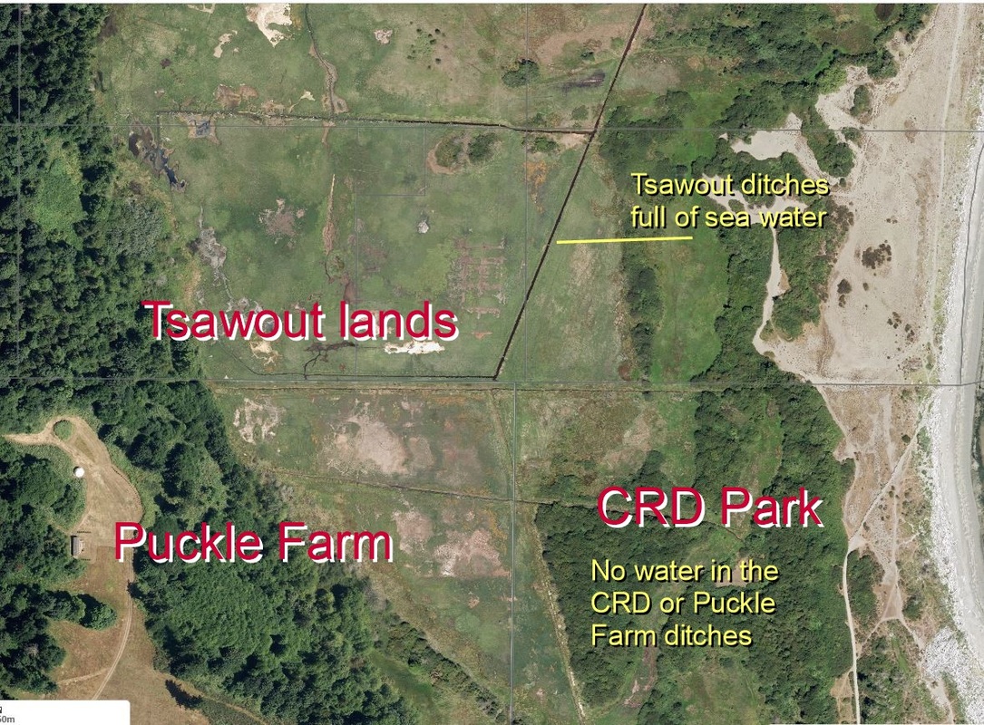
But this is an aerial shot from the CRD web atlas, showing the salt water in the Tsawout ditch system, while the Puckle Farm and CRD ditches are dry.
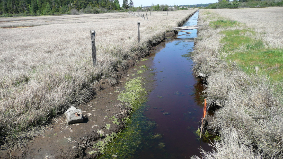
and this is a phot of the Tsawout ditch where it is close to Puckle Farm. The sea weed is evident:
and these are videos showing the sea water entering the Tsawout ditches. The CRD knew this.
|
|
|