Images over time
These two photos are to help orient you to the ones that will follow
|
|
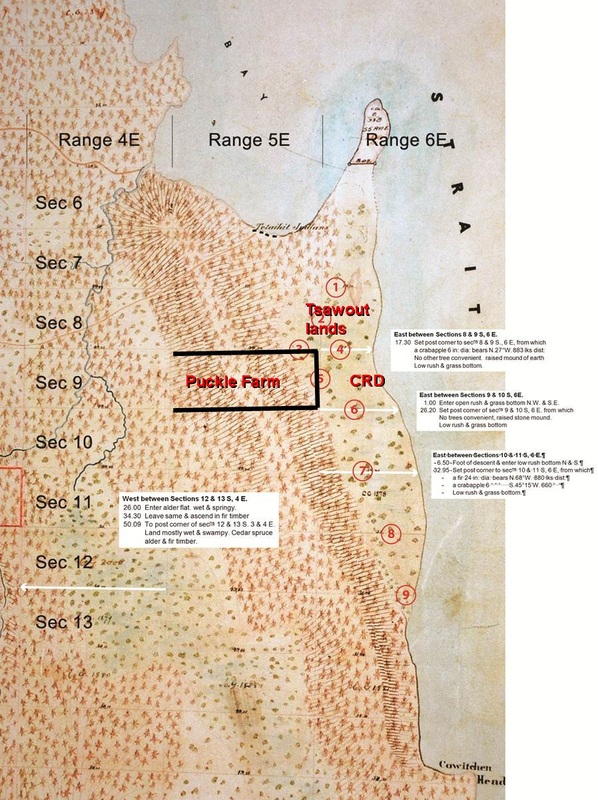
The John Trutch survey of 1858. The typed notes have been added for reference. The notes on a white background are from the surveyor's notes where he described the ground conditions.
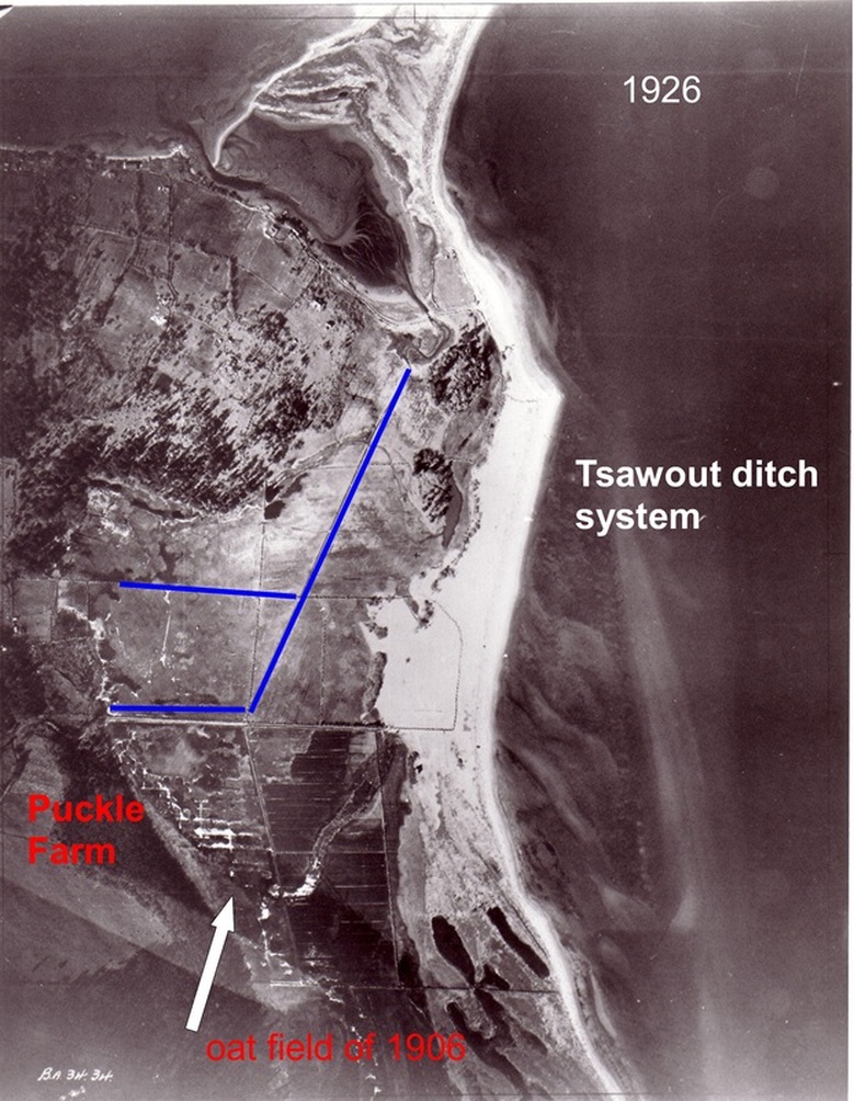
1926 aerial photo with the Tsawout ditch system shown (built in WWI by the military) In 1906 Puckle Farm had an 18 acre oat field where the arrow points - this is where in 2010 the Cordova Strategy claims it is a salt marsh. This photo was taken 10 years before the ditch system was built by the District of Saanich on this land for mosquito control.
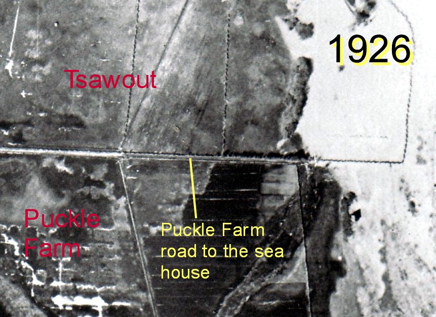
Enlargement of the 1926 photo showing the road Puckle Farm had alongside the Tsawout boundary, to their house by the sea. The triangular shape of the house roof can be seen to the right. This road runs right through the middle of what in 2010 the Cordova Strategy called a salt marsh!
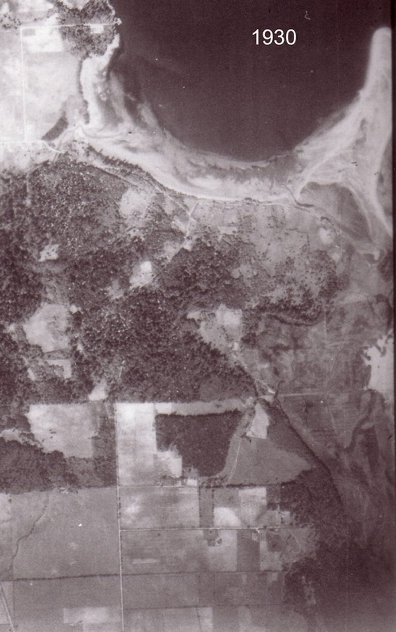
1930. Puckle Farm is the triangular showed wooded area in the middle. The flat lands and the sea are to the right. The road to the sea is the pale line.
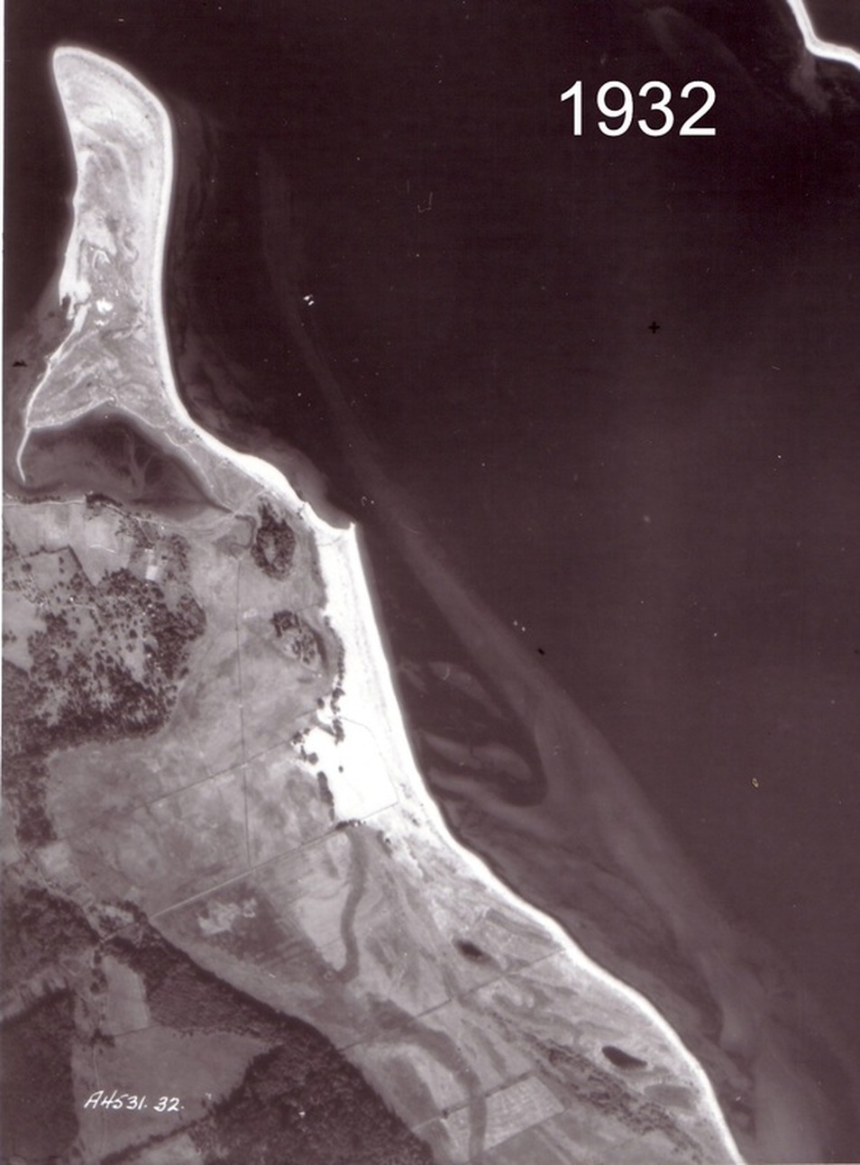
1932. Puckle Farm is where the writing on the photo is. It used to go all the way to the sea. In 1966 the CRD bought the seaward side from about where the dark band is.
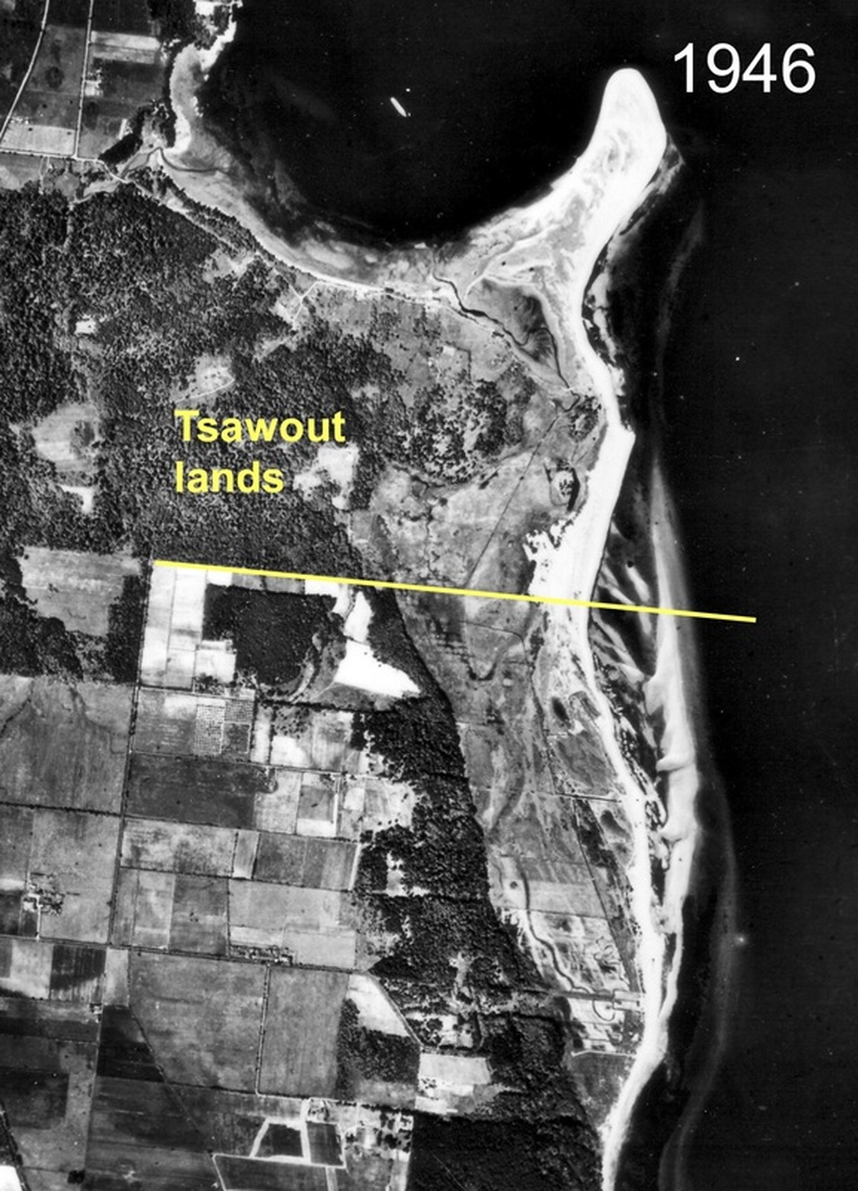
1946

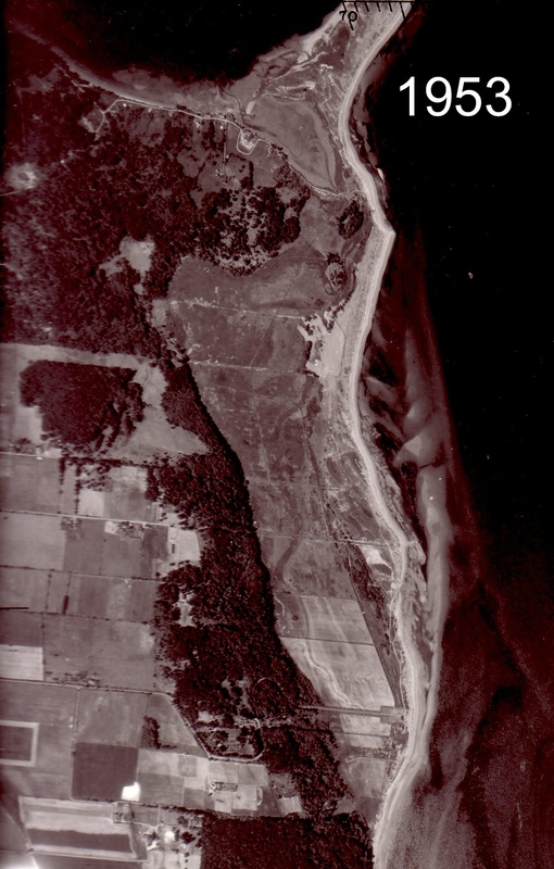
1953
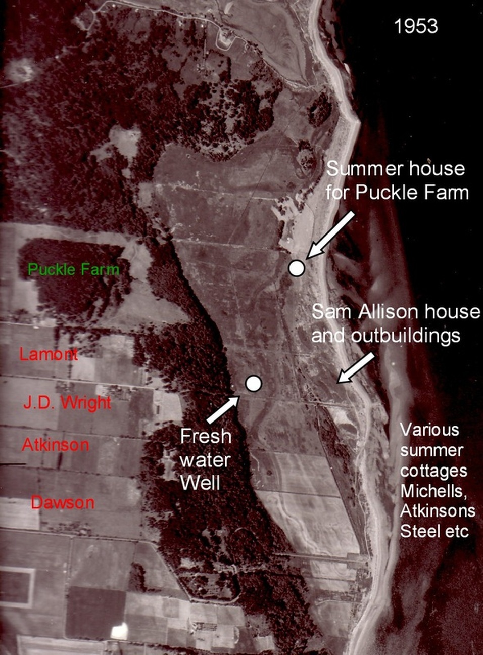
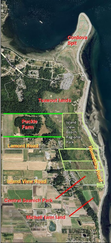
1953 photo showing names of some of the families of the time. Details given by Mr. Glen Lamont who grew up on Lamont Road which was named after his family.
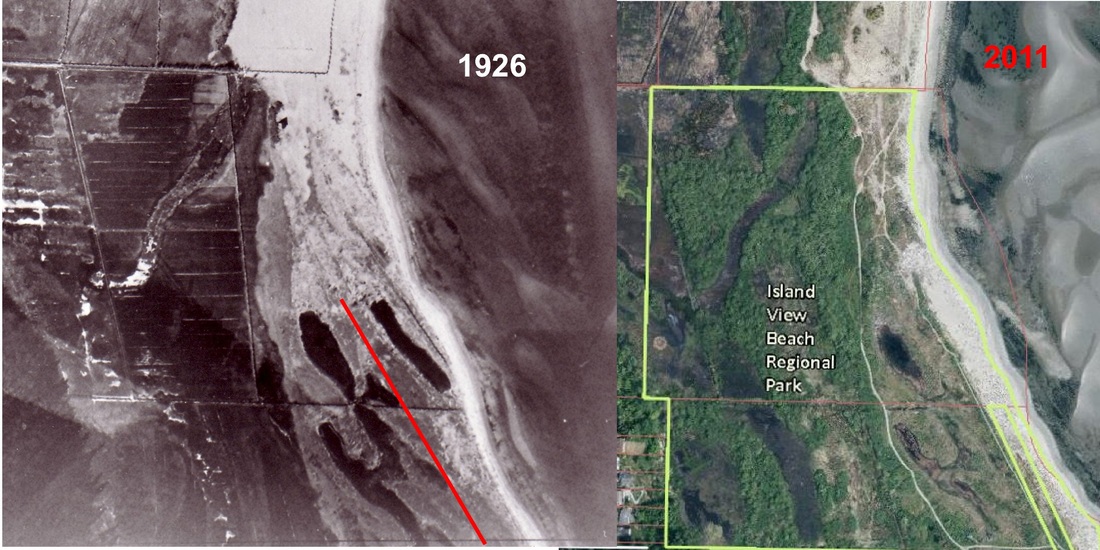
Comparison of 1926 to 2011 - shows the erosion to the coast line. The red line on the b&w photo shows where the present shoreline has eroded to.
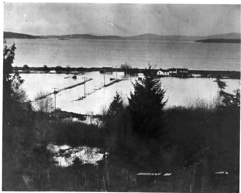
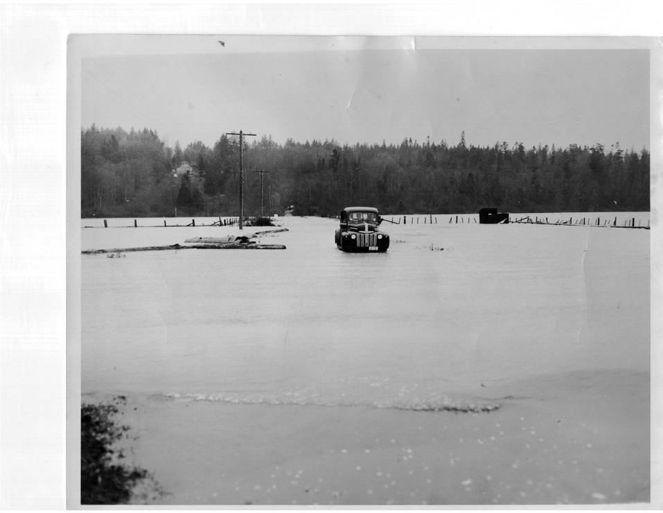
This is what happens when the sea wall is breached. CRD staff wanted to dismantle the sea wall.
Near the boat launch looking west along Island View Road - sea wall had breached.
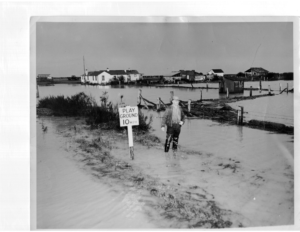
Island View Beach - sea wall breached
island View Beach
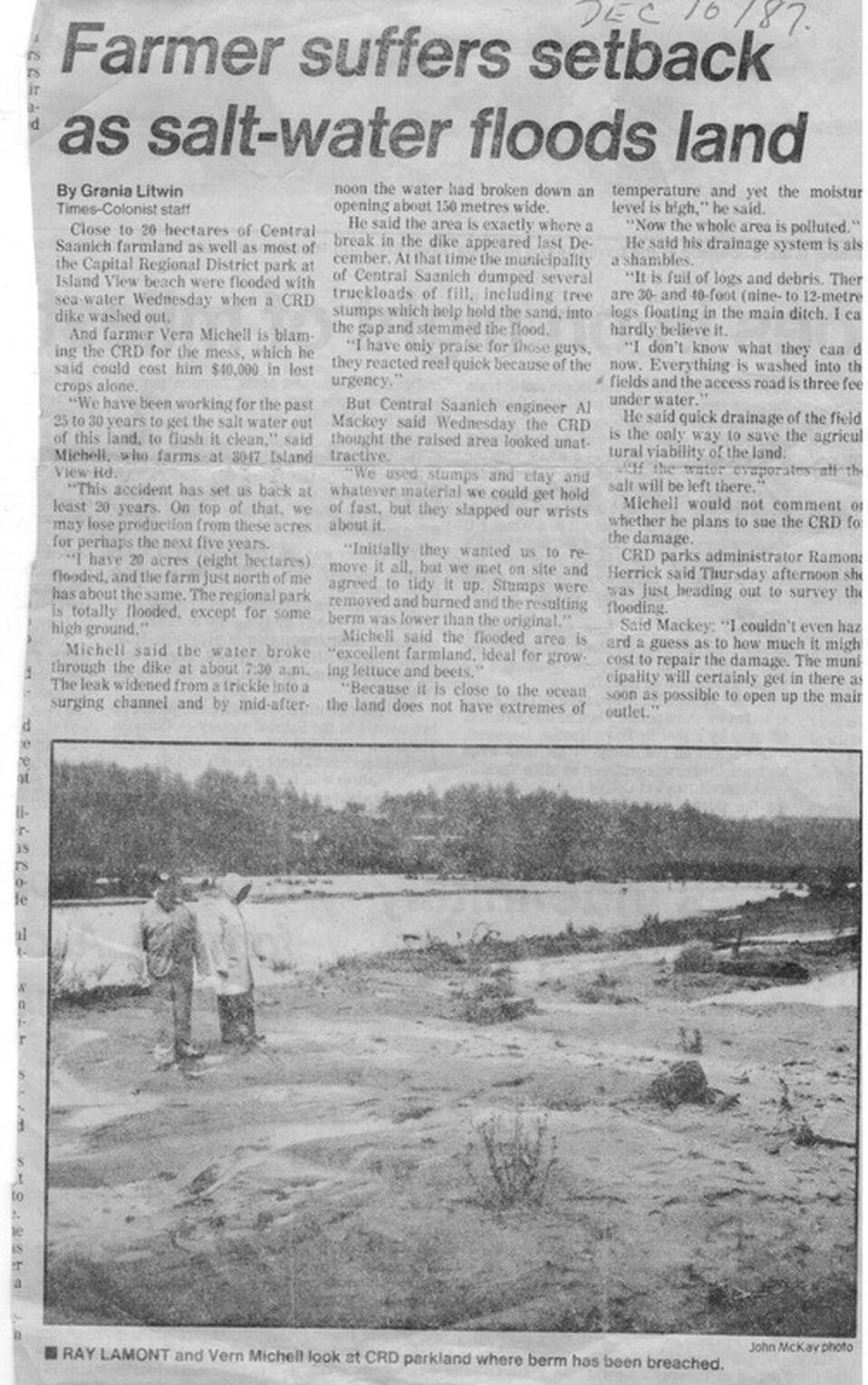
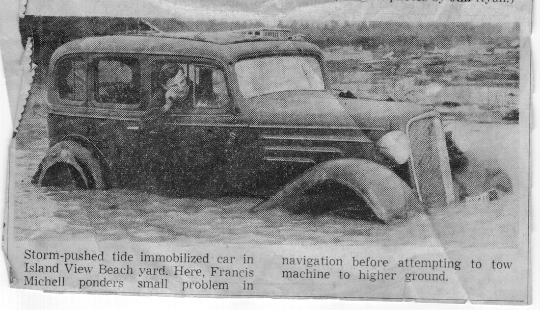
1987 - the most recent major breach of the sea wall. The story should be read to give an idea of how quickly a breach rips open the sea wall and the destruction caused. This is relevant because there is a breach to the natural berm at the north end of the man made sea wall. Central Saanich Council and a 500 signature public petition have called for that breach to be fixed before this happens. The Cordova Strategy which was managed by CRD staff, has a goal to dismantle the seawall to allow the park to be flooded like this.