The park ecosystems
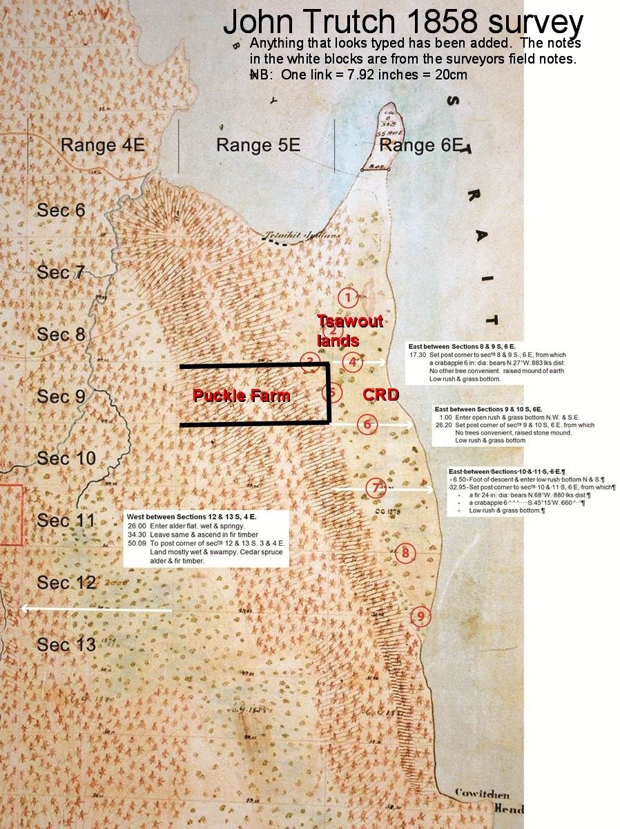
The 1858 survey - "low rush and grass bottom": This land was first surveyed in 1858, and the surveyor's notes for the junction of what is now Puckle Farm, the Tsawout lands, and the CRD park, described the flat land as "low rush and grass bottom", and in several parts he made reference to crab apple trees. There was no mention of water nor is there blue shading on the survey map, as the surveyor used to describe wet land on the other side of the ridge to the west.
Early settlors - journals of Puckle Farm
1892: "good land": The flat land of Puckle Farm, which lay to the south of the Tsawout lands and ran to the sea, (most of which is now the north part of the CRD park) was described in March 1892 as having 30 acres of good land.
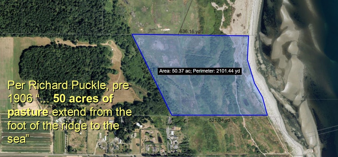
After 1892: "50 acres of pasture" Later there was another description of all the flat lands as 50 acres of pasture extending from the foot of the ridge to the sea.
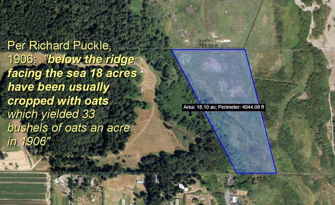
1906 And in 1906 the Puckle Farm flat lands were described as "below the ridge facing the sea, 18 acres have been usually cropped with oats which yielded 33 bushels an acre in 1906. East of this, 3 fields of about 9 acres each are pasture hitherto fed by sheep."
All these descriptions were of the natural state of the land prior to any drainage ditching, and were in the area the CRD claim to be a salt marsh. Clearly it was not a salt marsh when the first surveyor went there in 1858, nor would any farmer have described a salt marsh as "good land" or been able to grow oats there.
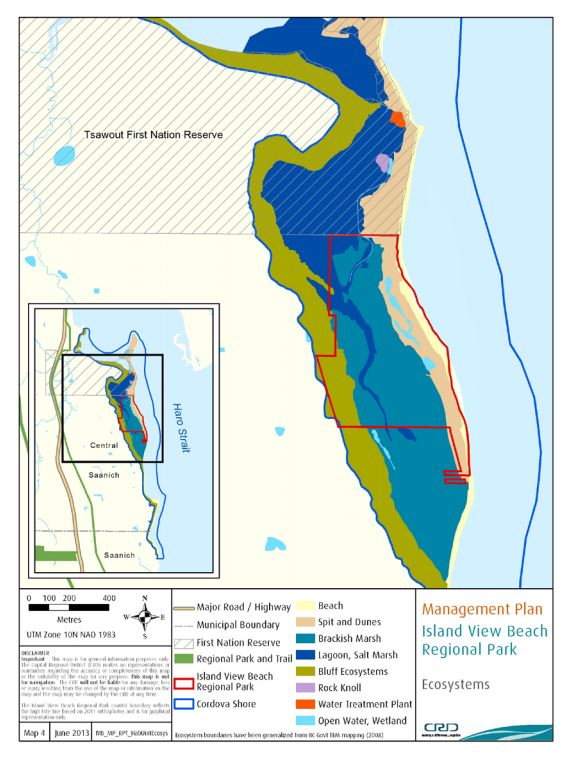
This is an extract from the 2013 CRD draft interim plan, claiming that the bulk of Island View Beach Regional Park, and all of the Tsawout and Puckle Farm flat lands to be either a salt marsh or a brackish marsh.
|
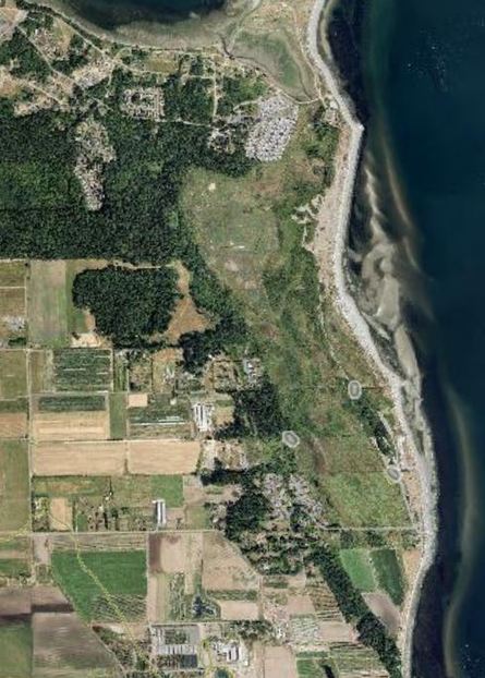
This is a CRD photo of the same site - does this look like a salt marsh?
|
|
A Black Press article published on October 30, 2013 of an interview with Dr. David Blundon of Camosun College quotes him as saying "We know that it was probably a wetland" but said that he acknowledged that doing away with the berms and ditches and allowing some Island View Park lands to flood would not result in a return to a pristine wetland that may have existed there one thousand years ago. While some of the flat lands may have been a salt marsh 1,000 years ago, they were not a salt marsh when the first European survey was made in 1858, and they are not a salt marsh now. |
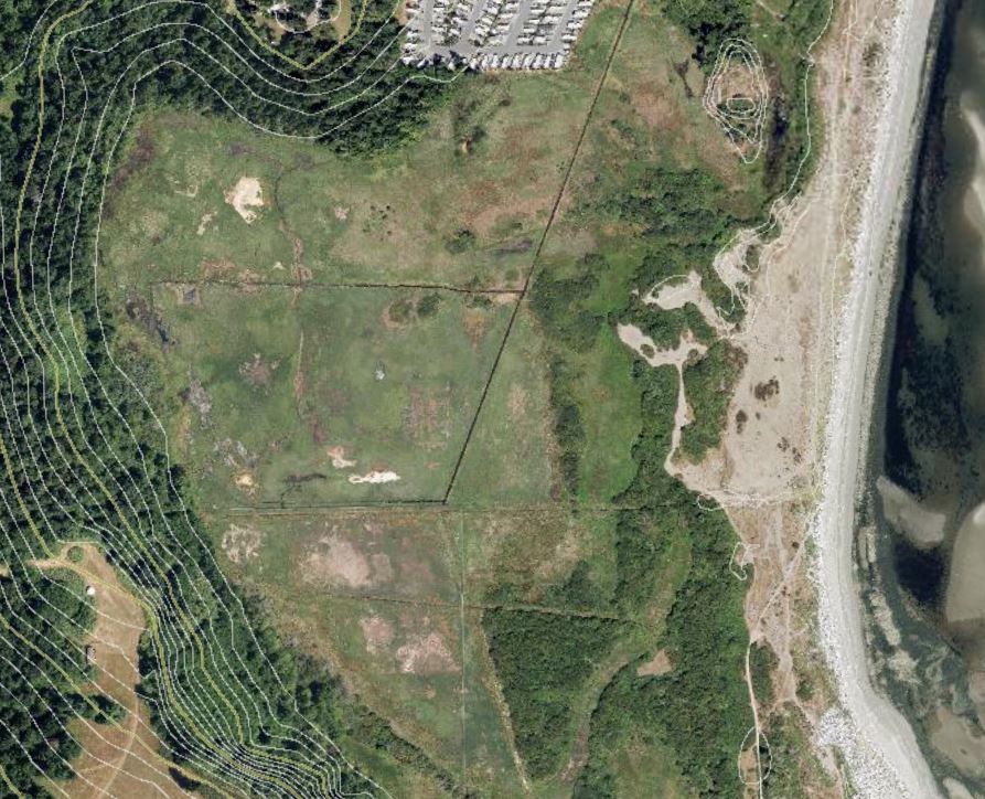
A close up image of the area claimed to be a salt marsh. The photo shows the salt water in the Tsawout ditch. This is because the flapper gate on the Tsawout ditch, although repaired, still allows salt water to pass through and come up the ditch up to 1km inland. Before the flapper gate had repairs done to it, the salt water used to come up in a surge and flood this area with salt water, thereby leading some to the mistaken impression it was a salt marsh.
|
To be called a salt marsh requires that it be flooded with salt water daily by tidal action. None of this area is naturally flooded with salt water by tidal action on a daily basis. The current misconception arose in the mid 2000's when people noticed that the Tsawout flats and Puckle Farm were flooded frequently with salt water but no one bothered to check why - they saw what they wanted to see. Had they investigated, as they should have, they would have seen the salt water flooding was a man made event. Ditching had been done on the Tsawout lands in the First World War to make the land suitable for the army to train. That should have been the first clue - no amount of ditching could convert a salt marsh overnight, or even in a few years, into something the army could train on. The second clue they overlooked was the limited ditching - only two ditches went into the Tsawout flat lands and they were spaced 200m apart. You don't drain a salt marsh with just two ditches 200m apart. The third clue was obvious if anyone had taken the time to look - the ditch system was protected by a flapper gate that been blocked in an open position that let sea water in at high tide. It was the combination this man made ditch that penetrated the naturally raised bank near the shore, together with the failure of the man made flapper gate, that lead to the Tsawout lands and Puckle farm being flooded with salt water for about 20 years until this was found in 2011 and the flapper gate was partially fixed in 2012. It was obvious, yet none of the experts bothered to check - they saw what they wanted to see. All the studies in the mid 2000's were based on this being a salt marsh - the 2009 Ministry of Environment Terrestrial Mapping, and the 2010 Cordova Strategy - they didn't check.
The land is flat. It is undoubtedly wet with fresh water in winter and spring just as is much of the low lying land on the Peninsula. And in some years in high winter storms it may have been occasionally flooded with salt water. But this land has not been a salt march for hundreds, perhaps thousands of years, long before contact with the Europeans.
Here is the BC Government definition of a salt marsh:
“A salt marsh is an intertidal ecosystem dominated by salt-tolerant emergent graminoids and succulents. They occur in the middle to upper tidal zones of estuaries where fresh water and salt water mix. Sites are alternately flooded and exposed daily. Elevationally banded surface patterns that reflect degree of tidal inundation are common.” http://www.ilmb.gov.bc.ca/risc/pubs/coastal/estuary/estuary-19.htm
And here is the CRD's own definition of a salt marsh
"Salt marshes lie at the edge of land and sea, on wave-protected coasts. They are dominated by low-lying, salt-tolerant vegetation and are laced with networks of tidal channels and pools. Salt marshes are communities of emergent herbs, grasses, or low shrubs, rooted in soils and alternately flooded and drained by tidal action." http://www.crd.bc.ca/watersheds/ecosystems/saltmarshes.htm
The CRD map also claims the large part of the southern part of the park is a brackish marsh. A marsh is defined as
Marsh: Areas with standing water for at least part of the year that are composed of non-woody standing vegetation.
http://www.americaswetlandresources.com/background_facts/detailedstory/types_wetlands.html
Anyone walking over this area, even in winter, will see the area is widely covered with woody standing vegetation and there is little standing water. While there are a few low lying areas with water in winter, as with any flat land on the Peninsula in winter, the bulk of this land cannot be classified as a brackish marsh.