The Centennial of Island View Beach Park
100 years a park 1916 - 2016
Thanks to the foresight and vision of Saanich Council, the first Island View Beach Park was created over 100 years ago in 1916, and was the IVB park for 50 years until 1966, when the CRD was formed and acquired the larger lands to the north. Today the original park is still there, but is overgrown and forgotten, seen only as lines on a map, with the remnants of fencing showing its boundary if one knows where to look.
This is its story, and our vision of what it can become again.
Telegraph Bay & Saanich
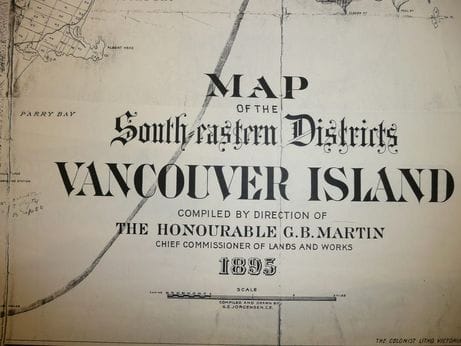
What is now known as Island View Beach, was called Telegraph Bay in the 1800's and early 1900's. The area was part of the District of Saanich until 1951 when Ward 6 voted along urban/rural lines, to secede as the District of Central Saanich.
The original Telegraph Bay Road went in a straight line east to the beach from what is now the Pat Bay Highway, and it was not until later years that the current loop was put in to take it around instead of straght over the last hill.
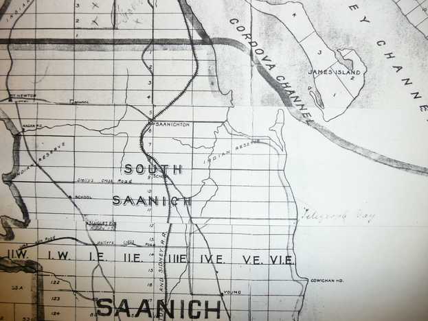
1895 map: - see the hand writing marking Telegraph Bay
This is its story, and our vision of what it can become again.
Telegraph Bay & Saanich
What is now known as Island View Beach, was called Telegraph Bay in the 1800's and early 1900's. The area was part of the District of Saanich until 1951 when Ward 6 voted along urban/rural lines, to secede as the District of Central Saanich.
The original Telegraph Bay Road went in a straight line east to the beach from what is now the Pat Bay Highway, and it was not until later years that the current loop was put in to take it around instead of straght over the last hill.
1895 map: - see the hand writing marking Telegraph Bay
|
|
In 1916 Saanich acquired 1/2 an acre at the end of Telegraph Bay Road (Island View Road) in exchange for building the cross road to the beach. And in 1917 Saanich acquired the 1/2 acre on the opposite side, in exchange for putting in flood gates at the end of the road. These two half acre parcels were the Island View Beach Park for 50 years until 1966.
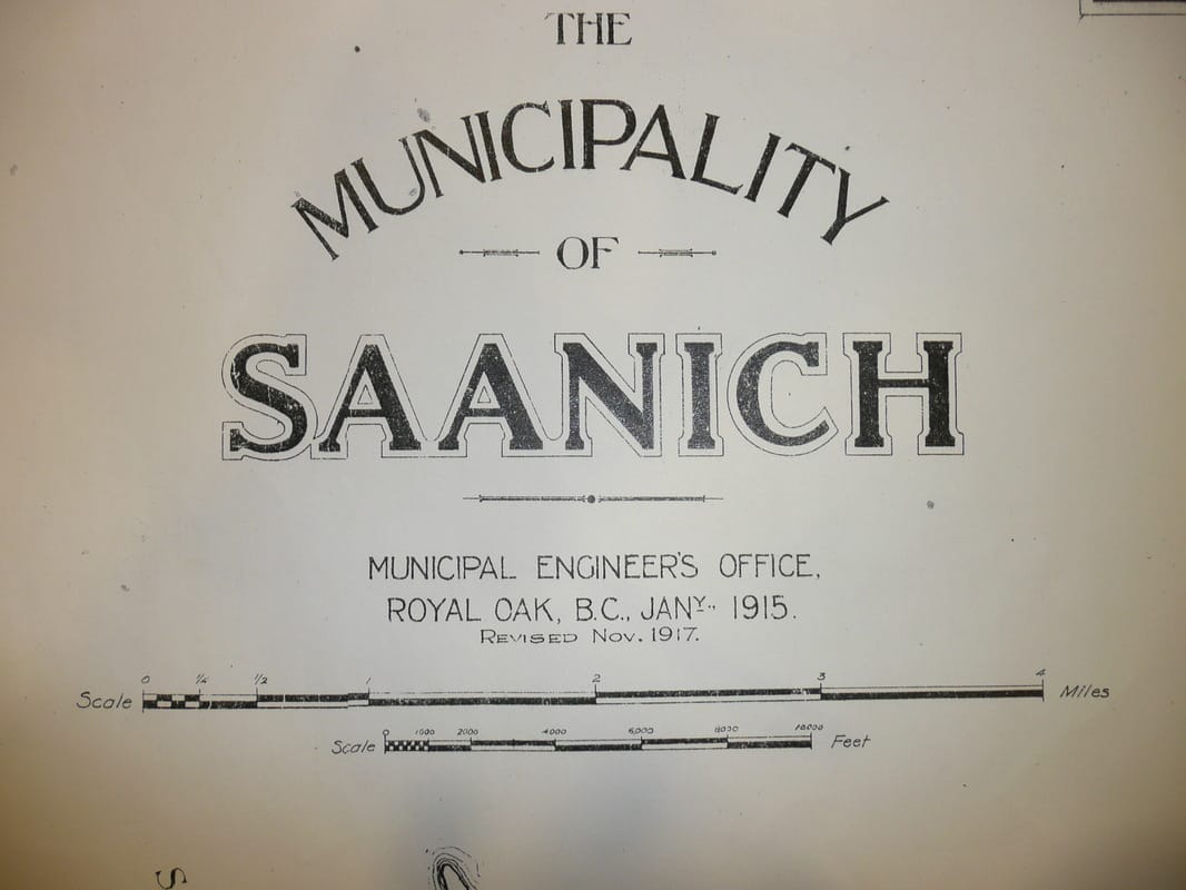
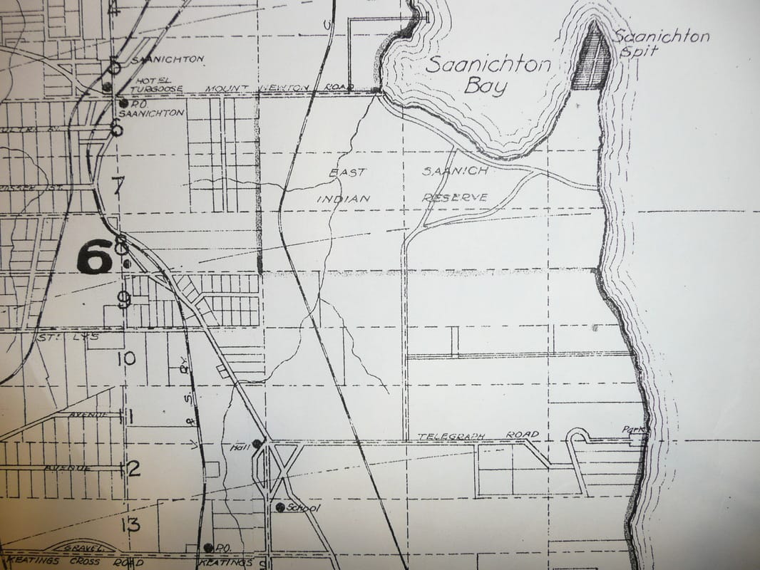
The November 1917 plan below shows the dog leg put into Telegraph Road to get it around the hill, and the new Island View Beach park at the end of the road by the shoreline. The new road shown parallel to, and north of Telepgraph Road, is Lamont Road. This 1917 plan shows at the west end of Telegraph Road, the still existing hall, and the site of the current Keating School.
The November 1917 plan below shows the dog leg put into Telegraph Road to get it around the hill, and the new Island View Beach park at the end of the road by the shoreline. The new road shown parallel to, and north of Telepgraph Road, is Lamont Road. This 1917 plan shows at the west end of Telegraph Road, the still existing hall, and the site of the current Keating School.
|
|

How to reach Island View Beach in 1916 as travelled by the Daily Colonist reporter in an Overland touring "four", 'one of the most popular cars on the market inVictoria'.
From the July 30, 1916 Daily Colonist article below. (distances in miles)
0.0 Leave Plimley's Garage, Johnson Street, near Douglas Street. East on Johnson Street to Quadra Street. North on Quadra Street.
1.6 City limits on Quadra Street.
5.1 Royal Oak. Take the left fork; the West Saanich Road.
5.5 Railway crossing, Victoria & Sidney Railway
6.1 End of pavement on West Saanich Road
6.6 Keep to the left.
6.8 Straight ahead, Goward Station on electric interurban on left.
7.5 Straight ahead, road to top of Little Saanich Mountain on right.
8.0 Straight ahead, Prospect Lake Road and Prospect station on left.
11.2 Right turn on Cross Road.
12.5 Railway crossing, Victoria & Sidney Railway.
12.8 Left turn.
13.1 Take the right fork.
13.4 Join Telegraph Road, keep to the right.
13.6 Railway crossing, New Canadian Northern Pacific Railway.
13.9 Straight ahead.
14.2 Straight ahead. From this point to the beach is the stretch of new road recently completed by the municipality. It is a spendid roadway although the surface has not yet packed firm.
15.3 Telepgraph Beach
The vision of Saanich Council was shown in a December 12, 1917 article in the Daily Colonist, that reported that the "Victoria-Saanich Beaches and Parks Committee" was being extended to bring under the committee's control all the beaches in Saanich municipality "that may be attractive to bathers, picnic and holiday parties." The intent being that the beaches be placed under regulation and improved with pavilions. "The sooner this committee gets control of all the beaches the better", said Mayor Todd.
100 years later, we owe a debt of gratitude to Mayor Todd and the other visionaries of 1916.
Saanich made good on its promise. A 1919 article said that the road there was paved most of the way to the beach, and that "there have been constructed beach conveniences and a tea house." The description of the approach to the beach is still recognizable today:
"There is one curving section of Telepgraph Road, where it slopes steeply down from the brow of the hi;; overlooking the water, which is well worth the trouble of stopping the car to examine at leisure the surrounding greenery, with the sweep of the the road below, the silver beach, blue waters of the Straits, dotted with island, and the far-off peaks on the horizon, all combining to make a setting long remembered."
A major change at Island View shown by the articles, is the loss of sand. The 1916-1919 articles extol the sandiness of the beach which is not present today, and with the decline in the sand has been the parallel decine in what used to be sheet sand in the north east of the current CRD park, and the former sand dunes on the Tsawout lands. Those areas are becoming organic because there is no longer makeup sand being deposited on shore. It is not known why this change has come about about - the sand is believed to have come from the collapse of the cliffs along Cowichan Head, and despite their continued collapse, the sand is no longer appearing on the beach or on shore as it was described in 1916-1919:
Daily Colonist, May 11, 1919 "The expanse of sand uncovered at low tide stretches for five hundred feet below high watermark, which again is, on average, a hundred feet below the line at which the dry sand comences." A beach with one hundred feet (30m) of sand at high tide, and another five hundred feet (150m) of sand at low tide, is something we can only dream of today.
These are articles from the Daily Colonist: - click on the blue link to see them
1916 July 30th
1917 August 4th
1917 November 27th
1917 December 12th
1918 November 20th
1919 May 11th
1919 August 17th
1919 September 3rd
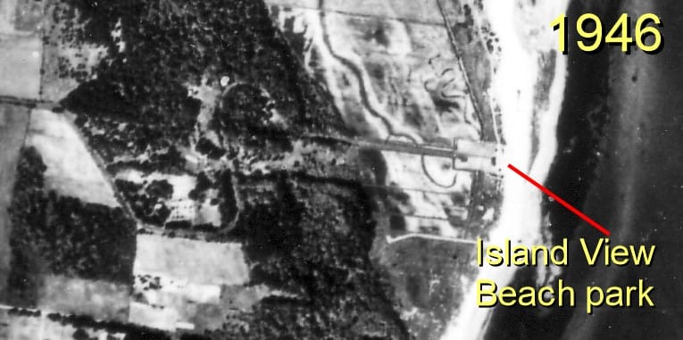
Showing the park in 1946
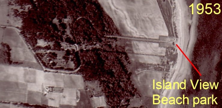
Island View Beach park in 1953
|
Circa 1955 - showing the end of Island View Road. The indent on the right is the southerly 1/2 acre of the park.
|
|
|
Circa 1955 - at the beach end of Island View Road looking west - the two 1/2 acre sections of the park can be seen from the fence lines on the left and right.
|
|
|
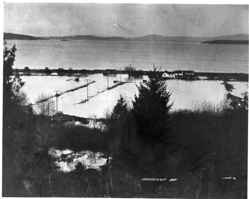
Circa 1955 - looking down on Island View Road. The park can be seen at the end of the road by the fence lines. Also shown is the pavilion built by Saanich around 1919.
|
|
|
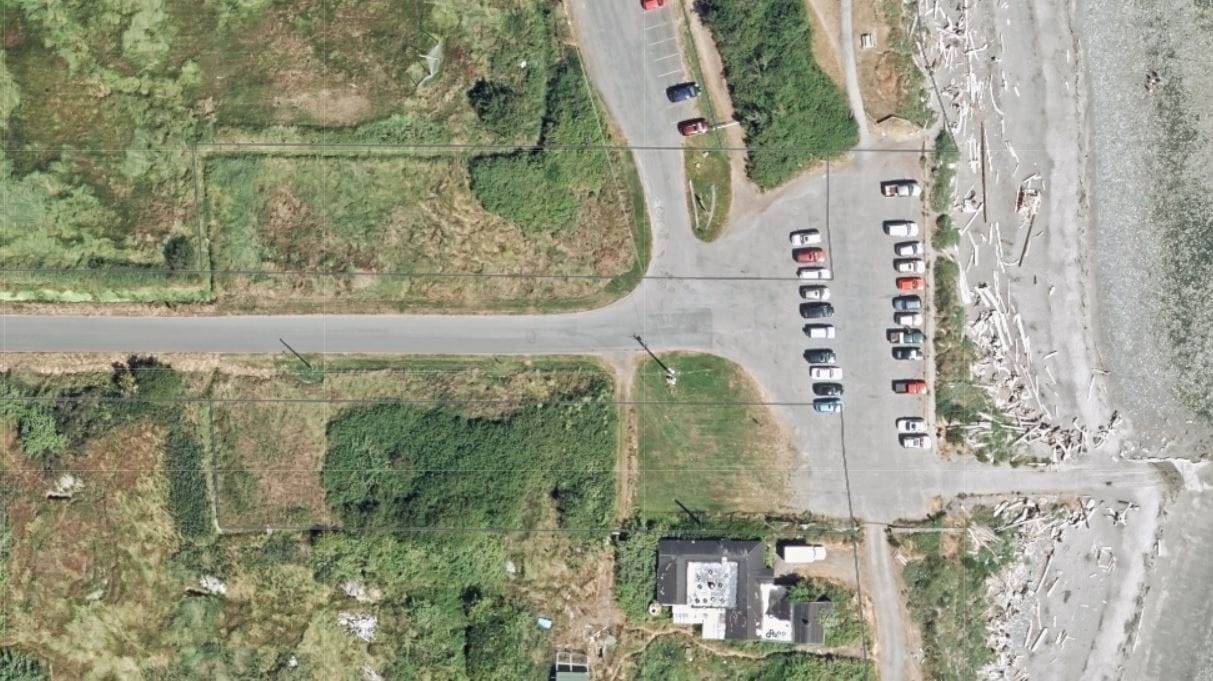
Aerial photo in 2013 showing the outline of the original park by the ditches and fence lines. Now overgrown and forgotten.
|
|
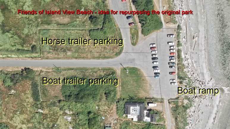
There is already a critical shortage of parking at the beach that will only become worse as the usage of the park continues to grow, and when the boat ramp is repaired, and when equestrians return to the park.
We believe both areas should be gravelled, and the south one be dedicated to parking of boat trailers, and the north one to horse trailers.
We believe both areas should be gravelled, and the south one be dedicated to parking of boat trailers, and the north one to horse trailers.
|
The Friends of Island View Beach vision to repurpose the orginal park for use as boat trailer parking for the boat ramp on the south side, and horse trailer parking on the north side.
|
|